
November 7, 2022 South Basin Initiative
Our South Basin Initiative generally includes the portion of the Lake George watershed that lies within the Village and Town of Lake George, Town of Queensbury, the Pilot Knob area of the Town of Fort Ann, and the southern portion of the Town of Bolton. Butternut Brook, East Brook, West Brook, Smith Brook, English Brook and Edmunds Brook, as well as a number of other minor tributaries, all flow through these towns, and constitute the headwaters of Lake George.
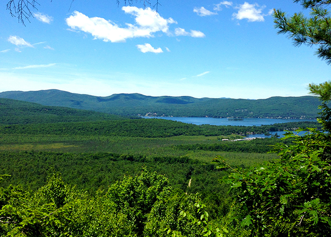
Lake George flows south to north. Water entering the Lake from the south end, the Lake’s headwaters, travel the greatest distance – some for the entire 32 miles – before emptying into the La Chute River in Ticonderoga, and then to Lake Champlain.
Because these headwaters persist in Lake George for so long, they can have the greatest impact on the water quality of the entire Lake. The protection of these waters, and the land that surrounds them, is therefore a very important conservation priority for the health of the Lake George watershed.
Since our inception in 1988, we have completed 19 projects within the South Basin Initiative area, permanently protecting more than 2,600 acres of land and 450 feet of shoreline.
These south basin accomplishments include our very first project: a conservation easement on land in the Town of Lake George in December of 1988; and our largest: the purchase of Berry Pond in 2008, a 1,436-acre tract within the Towns of Lake George, Warrensburg, and Lake Luzerne.
Some of the most recent south basin projects have included the 317-acre McPhillips Preserve created in 2018 in partnership with the Towns of Lake George and Queensbury, as well as the 150-acre addition to protected lands at Prospect Mountain secured in 2021.
Urgency for Action
Now, more than ever, there is urgency to this work at the southern end of Lake George. Development pressure within the south basin is tremendously high because of its convenience: properties in the south are closer to transportation, the amenities that come with the urban area of Lake George Village, and zoning that is more favorable to development.
This means that natural forested lands in the southern basin are more likely to be developed than other regions of the Lake, converting forestland to other uses and creating impervious surfaces that will negatively impact water quality.
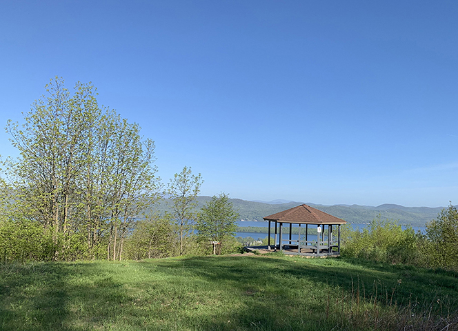
In addition to protecting water quality, the South Basin Initiative aims to preserve the scenic beauty and sense of place that makes Lake George so attractive. Providing low-impact recreational opportunities aligns with the outdoor tourism economy that is so important to communities in the south basin.
Given the number of visitors to this area, land protection projects have high visibility and therefore provide a great opportunity to raise awareness about the importance of protecting the Lake by protecting the lands around it.

Progress
2024: On July 10, 2024, the LGLC permanently protected 42 acres of forested land in the Town of Lake George through the purchase of a conservation easement from the Wiawaka Center for Women (Wiawaka). Under this conservation easement, the land continues to be privately owned by Wiawaka, and the LGLC will ensure the land’s permanent protection and assist with its stewardship. Read more about our Wiawaka Uplands Project here.
As testament to the quality and importance of this project, in 2022 the LGLC was awarded one of just four grants state-wide in support of conservation easements on forested lands. The $350,000 grant award was announced during a press conference at Wiawaka in October of 2022. The funds were made available through the Forest Conservation Easements for Land Trusts Grant Program, which helps increase the pace of forest land conservation to keep forests as forests and continue to help combat climate change.
2021: The LGLC purchased 150 acres adjoining Prospect Mountain, within the Towns of Warrensburg and Lake George. The property includes the headwaters of a main branch of West Brook, one of Lake George’s largest tributaries. In total, more than one mile of stream corridor has been protected.
2019: The LGLC received a donation of 13 acres along Warner Bay. The property adjoins the larger 1,400-acre Dunham Bay Marsh owned and protected by New York State (NYS) Department of Environmental Conservation (DEC) since 1980.
After the success of the West Brook Conservation Initiative (see 1999-2008, below), the LGLC saw an increase in community generosity through donations of land and conservation easements.
2018: On October 18, the LGLC closed on the purchase of 317 acres on French Mountain, which lies within the Towns of Lake George and Queensbury. The property, now called the McPhillips Preserve, was then sold to the Towns of Lake George and Queensbury in January 2019, subject to a conservation easement held by the LGLC.
More than 2,000 feet of seasonal streams flow down the steep slopes of the property and join with East Brook far below. Keeping the land in an undeveloped state ensures that the water flowing down its slopes is kept clean and free of excess nutrients and sediment. In addition to offering permanent water quality protection, the land will provide recreational opportunities. The towns plan to create a multi-use trail system on the property, which the LGLC will help to maintain.
We also received a donation of nearly one acre of land in Fort Ann that contains 50 feet of stream corridor.
2017: The LGLC purchased nearly 12 acres in Lake George along the main branch of East Brook, one of the top ten tributaries of Lake George. We are developing a trail system on this property that will ultimately connect to the McPhillips Preserve and the Lake George Elementary School nature trails.
We also received a donation of 15 acres on the southeast shoulder of Sugar Loaf Mountain at the south end of the Pilot Knob ridgeline in Fort Ann, and a conservation easement donation on nearly 48 acres in Diamond Point.
2014: Donations of two parcels totaling 234 acres in the Towns of Lake George, Lake Luzerne and Fort Ann (Read more about these here.)
This decade was especially busy and successful for the south basin as we completed seven conservation projects, totaling 1,816 acres within the South Basin Initiative region.
In January 2008 we purchased the 1,436-acre Berry Pond tract in southern Lake George for $2.654 million, as part of the West Brook Conservation Initiative. The purchase marked the largest dollar purchase in LGLC history and the largest acreage purchased at one time from a single landowner. This property includes the headwaters of West Brook, a tributary that has a significant impact on the water quality of Lake George, and lies within the towns of Lake George, Lake Luzerne and Warrensburg.
New York State purchased the Berry Pond property from the LGLC in 2015, adding it to the State Forest Preserve and further ensuring the permanent protection of the land that is so vital to the water quality of Lake George.
The West Brook Conservation Initiative was a coordinated effort by Warren County, the Village of Lake George, New York State and the Lake George Land Conservancy, the Fund for Lake George (now merged with the Lake George Association), and the Lake George Association. The project’s intent was to dramatically reduce the sediments and pollutants that were running freely into West Brook and subsequently into Lake George near “Million Dollar” beach.
In addition to the permanent protection of the forested uplands, the West Brook Conservation Initiative was tasked to restore “Gaslight Village” to its original state as a natural water-filtering wetland and to create a complex series of stormwater management devices to capture sand and sediment before they reach the lake.
In July of 2000, the LGLC purchased 216 acres in Fort Ann, property that is now know as the Schumann Preserve at Pilot Knob. Originally, this parcel was illegally cleared and a house and mile-long driveway were constructed. The five-acre house lot became a focal point throughout the south basin, because it disrupted the unbroken wilderness of the Pilot Knob range. Further proposed development would have greatly changed the quality and character of the entire basin.
The property was subsequently confiscated by authorities and resold to the Zug family who stewarded the land for over 10 years. With the help of hundreds of donors and a selling price well below market value, the LGLC was able to purchase the property from the new owners.
This property, first named the Pilot Knob Ridge Preserve, was renamed on August 9, 2010 at a dedication ceremony in honor of LGLC’s past executive director, Lynn LaMontagne Schumann, who was instrumental in its preservation. Lynn passed away from breast cancer on March 13, 2010.
During this timeframe we also purchased 12 acres in Fort Ann, were assigned 128 acres protected by deed covenants and restrictions in Queensbury, and received two donations within the Town of Queensbury: a conservation easement on 12 acres, and nearly one acre of shore front property.
In 2003 a 2.7-acre wetland property in the Town of Fort Ann was transferred to the LGLC from The Nature Conservancy (TNC). The land, known as the Butternut Brook Preserve, was gifted to TNC by a donor who wished to see it protected.
The LGLC’s very first land conservation accomplishment was the protection of one acre of shoreline property in the Town of Queensbury with a conservation easement in 1988.
In 1993, we received a donation of 77 acres adjoining Prospect Mountain in the Town of Lake George, which we subsequently donated to New York State to be added to the special-use area surrounding Veterans Memorial Highway.