April 21, 2022 Sucker Brook Conservation Initiative
Town of Putnam
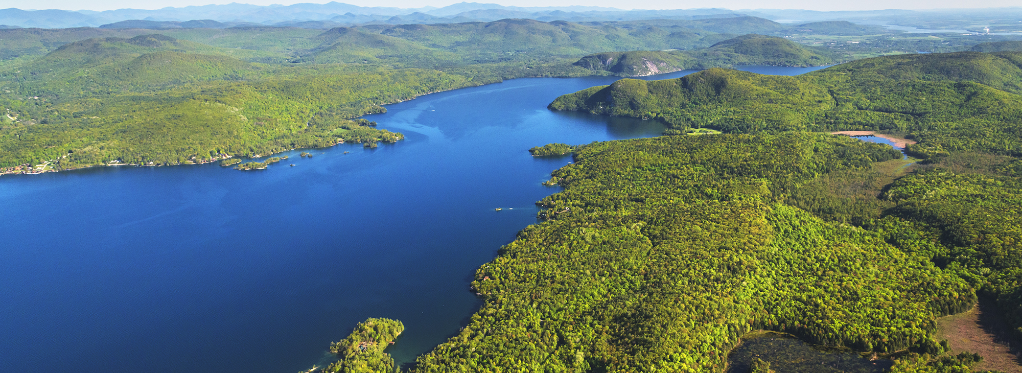
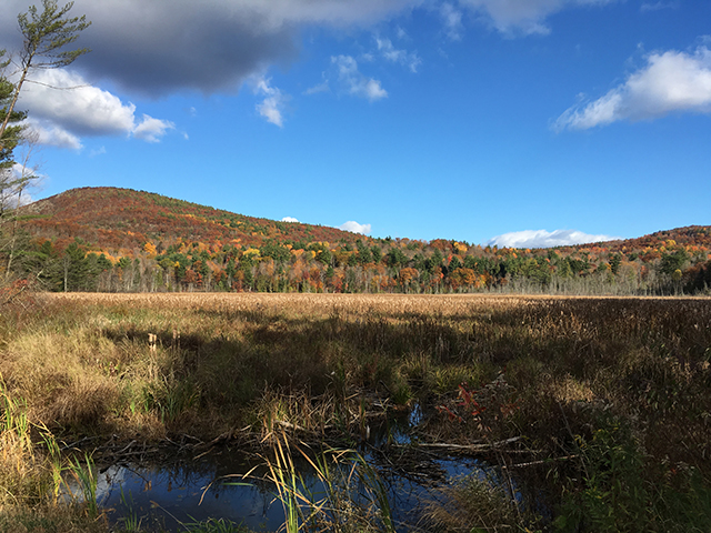
Sucker Brook is one of Lake George’s ten largest tributaries, encompassing about 1,570 acres in the Town of Putnam, Washington County. For this Initiative, the LGLC has focused its efforts on a total of 4,600 acres, including Sucker Brook and its wetlands, and a surrounding buffer of healthy forests, sensitive slopes, and amazing ecological treasures in the region.
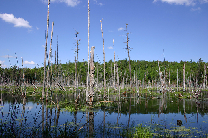
Our work protects this land forever and allows water to freely flow from the headwaters of Sucker Brook into Lake George. The naturally occurring filtration process of healthy wetlands and beaver ponds, with its surrounding forests, ensures the water is clean before it reaches the lake. Beaver ponds have been shown to be particularly beneficial for water quality. Studies indicate that these ponds can trap and remove nearly 50% of excess nitrogen from the water. High levels of nitrogen, resulting from chemicals like lawn fertilizers being carried downstream in storm water, can trigger algal blooms and fish kills.
Like our other Initiatives, this has been an ongoing, long-term effort. Beginning with the protection of Lamb Shanty Bay uplands in 1993, the LGLC has completed large and small acquisition projects to protect these lands, each with its own history, and some becoming preserves with public hiking trails. Anthony’s Nose hosts nesting peregrine falcons and is an historic icon; the Gull Bay Preserve contains multiple beaver ponds and a great blue heron rookery; the Last Great Shoreline has expanded through numerous conservation projects to include large swaths of wetlands and a rare white cedar swamp.
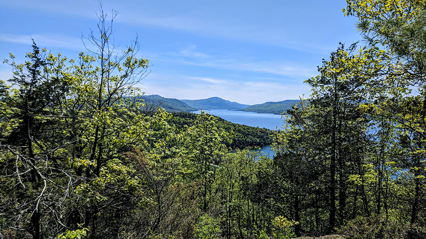
Today, the LGLC has protected 14 properties totaling 2,085 acres within the scope of this Initiative. These protected lands include nearly 300 acres of wetlands, along with two and a half miles of lake front and nearly three miles of streams.
Thanks to our generous supporters, land protected through these efforts will continue to filter and clean the millions of gallons of water that flow over and through it on its way into Lake George for many generations to come.
Progress
The LGLC partnered with the Rota family – Joseph Rota, and his daughter and son-in law, Amy and Pierre Poulin – to protect 154 acres adjoining the Last Great Shoreline Preserve*. With this purchase, completed in April of 2021, 26 acres of wetlands have been permanently conserved and 10 homes and septic systems prevented. Preventing impervious surfaces and development on upland properties like the Rota piece prevents sediment carrying excessive nutrients from reaching the lake.
The conservation of this property was made possible thanks to individual donations, a grant from The Nature Conservancy, and the LGLC’s Rowan Land Opportunity Fund, an internal resource that allows us to act quickly, when land is most vulnerable.
*In celebration of this most recent purchase and all of the past protection efforts to protect Sucker Brook, we are renaming the Last Great Shoreline and adjoining Gull Bay Preserves to be the new Sucker Brook Preserve. Updated trail signage and other materials will be completed in 2022.
The LGLC protected three properties in 2016, totaling 148 acres. Two of these achieved additional Sucker Brook protection, and one provided enhanced access to Flat Rock.
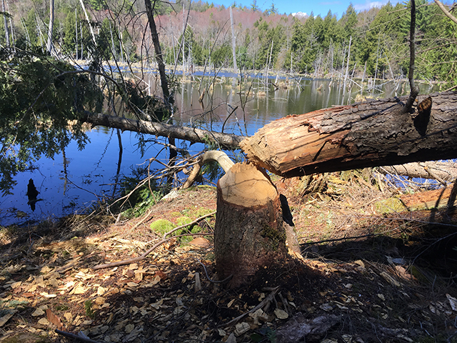
The Sucker Brook properties included the 72-acre beaver pond north of Warrick Road, and 65-acre rare white cedar swamp to the east of the Last Great Shoreline property. Trails now extend to both.
In August of 2015 we received a donation from the Tsu family of 6 acres with 255 feet of lake shoreline, adjacent to the Last Great Shoreline property. The protection of the property, which has steep rocky slopes, prevented development on a sensitive waterfront parcel and provide a buffer to the LGLC preserve. Due to its location near residences, LGLC will not create trails or other recreational infrastructure for the property.
In April of 2014 we acquired 3 acres that allowed us to connect the Last Great Shoreline Preserve to the Gull Bay Preserve. A through-trail was quickly created, establishing the extensive, connected trail system we have today.
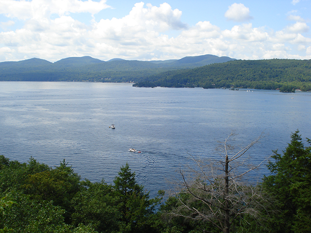
This momentous year concluded nearly two decades of negotiations when we purchased what was to become the Last Great Shoreline Preserve. In total, the acquisition included 351 acres and 2,357 feet of shoreline. In addition, 70 acres and 1,613 feet of shoreline were protected through a deed restriction and remains in private ownership.
The Last Great Shoreline was the largest, undeveloped, privately owned parcel remaining unprotected in Lake George. Lying just south of Anthony’s Nose and Adirondack Camp, a popular kids’ summer camp, the land is visible from the shoreline of Hague, Friends Point and Island Harbor.
The Gull Bay Preserve was purchased in April of 2003. This 434-acre woodland hillside property contains old logging roads and an extensive beaver pond and wetland network that represents the southern portion of Sucker Brook. In autumn, significant numbers of migratory waterfowl rest in the wetland before their journey south to warmer climates. On of these ponds is a great blue heron rookery (nesting colony) during its active season of March through July.
In December 2000, the LGLC acquired the 189-acre Lake George historic landmark locally known as Anthony’s Nose. This spectacular property includes 3,550 feet of shoreline and dramatic calcareous cliffs depicting the distinct profile of a Native American chief on its south face. One of the LGLC’s goals for Anthony’s Nose was the protection of the endangered peregrine falcons that nest on the cliffs.
Anthony’s Nose is contiguous with the 242-acre Flat Rock, which LGLC purchased in 1998 from the Fort Ticonderoga Association. With the purchase of Anthony’s Nose, the Lake George Land Conservancy increased the protection of Lake George’s northeast shoreline from Flat Rock, around the point of Anthony’s Nose to Glenburnie; an astonishing 9,000 feet of pristine shoreline including nearly 500-acres of forested upland. Flat Rock was transferred to New York State in 1999.
The earliest project within this Initiative was the conservation of the Lamb Shanty Bay uplands, at the Initiative’s most southern region. This 478-acre property was protected through deed restrictions, and continues to be in private ownership.
![]()
LGLC Protects 154 Acres in Putnam, Expanding Sucker Brook Conservation, posted May 13, 2021
LGLC Receives $25k Grant for Land & Water Protection in Putnam, posted May 5, 2021
LGLC Takes Steps Towards Completing Vision of Protection in Putnam, posted November 22, 2016
LGLC Secures Public Access for Anthony’s Nose, posted March 31, 2015
LGLC Announces Completed Conservation Projects, Changes Ahead, posted December 10, 2014